Soil and Land Use Survey of India,Department of Agriculture and Cooperation,Ministry of Agriculture, Govt. of India is an apex institution in the country for conducting Soil Survey since 1958.It operates from its Head Quarter at New Delhi through seven centres located at Noida, Kolkata, Bangalore, Nagpur, Hyderabad, Ranchi and Ahmedabad.The mandate of the organization is to provide detailed scientific database on soil and land characteristics to various State user departments for planning and implementation of soil and water conservation in the watershed based programme for Natural Resources Management.The major activities are : 1) Reconnaissance survey 2)Detailed soil survey 3) Land Degradation Mapping 4) Soil Resource Mapping 5) Development of digital watershed Atlas of India 6) National Database 7) Biannual short course training programme on soil and land resource Inventory for integrated Watershed management for the officers of state user departments.
|
|
|
|

Micro watershed Atlas of India
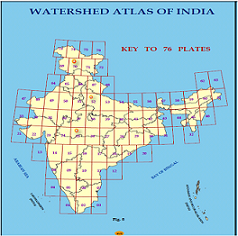
The Micro watershed Atlas of India aims at identifying and recognizing each micro watershed in the country with distinct spatial extent and Unique National Code. The state wise publication of atlas has been contemplated considering enormous volume of spatial data available with SLUSI. The Micro watershed atlas of India has been designed in such a way that user shall be able to locate and identify the micro watershed of his interest falling in different districts of different states of India..Click for more information
Guidelines for development of State-wise Digital Microwatershed Atlas